How higher quality data can help improve urban planning and reduce inequities
Local-level, high-quality data can provide powerful insights for urban planning and lead to better policies on mobility, climate adaptation, gender equity and more. But only if the inputs are good and there’s enough capacity to analyse it effectively.
New technologies like the Million Neighbourhoods Map, a tool designed to detect gaps in services at the neighborhood level, are helping to improve the quality, granularity and availability of data for city planning. They are particularly useful in informal settlements. Using algorithms applied to data from the open-source GIS database, OpenStreetMap, the Million Neighbourhoods Map identifies communities down to the block level with limited access to street networks, a variable which the University of Chicago’s Mansueto Institute for Urban Innovation says is an effective proxy for access to other core urban services.
In areas where buildings have limited access to streets, a lack of routes or access points tends to hinder the physical delivery or availability of services, including clean water, emergency services and transportation. Also, buildings not located on streets lack official addresses, making it more difficult to organise the formal delivery of services such as trash collection, says Sophia Vitello of TheCityFix.
‘Poor access to services can cause poor health outcomes’
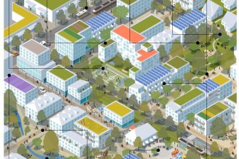
On this map of Dar es Salaam, the red zones represent low-access neighbourhoods, areas also most likely to be informal settlements, established with minimal planning and little essential infrastructure. Mapping and understanding the extent of these informal areas is a major challenge in today’s fastest-growing cities, as many cities are not keeping up.
Poor access to services can lower productivity, reduce opportunity, cause poor health outcomes, inflict serious environmental consequences and trap households into poverty for generations. Conversely, focusing on better reaching under-served populations can transform cities and provide benefits to all residents.
In Dar es Salaam, there are far more red, low-access zones compared to blue ones, indicating high informality and a potentially large “urban services divide” between the wealthiest and poorest households. Indeed, we know low-income households in Dar es Salaam typically spend 17 per cent of their income on piped water (where the option is even available) and 38 per cent on communal water supply (where it is not), much higher than the United Nations Development Programme’s recommended three per cent of income.
In order to address informality and service gaps, the government of Dar es Salaam implemented the 20,000 Plots Project, designed to provide planned and serviced land. Unfortunately, less than 17 per cent of the plots were small and affordable, which left out low-income residents and instead generated greater informality. Additionally, many of the plots still never gained access to core urban services, as WRI research explores.
‘Inform better urban planning that benefits all residents’
In contrast, programmes in Mumbai and Chennai, India, and Windhoek, Namibia, have successfully fostered more planned and serviced settlements. In India, the introduction of smaller and more varied plot sizes, infrastructure standards, and prices for different groups helped contribute to well-planned, well-serviced, mixed-use, mixed-income neighbourhoods. The program connected selection of plots with connectivity to employment and transportation and allowed space for social services and commercial enterprises run by community residents to flourish. In Namibia, the Windhoek city government in cooperation with the Shack Dwellers Federation of Namibia successfully lowered the cost of formal housing by changing building codes, reducing minimum plot sizes and lowering infrastructure standards.
Even in cities where data collection is still being developed, tools like the Million Neighbourhoods Map can help identify informality and poor access to services to inform better urban planning that benefits all residents. Other similar initiatives building on the type of open and granular spatial data available from OpenStreetMap are helping cities address urban climate risks and respond to humanitarian crises. Making sure that such localised data on gaps in access to services is used as input to decision-making at all levels is crucial to ensure more equitable outcomes for the most vulnerable urban residents.
Sophia Vitello is a Communications and Engagement Assistant with WRI Ross Center for Sustainable Cities.
First published by TheCityFix.com, part of the World Resources Institute, and reproduced here under Creative Commons Licensing guidelines.